चित्र:2011 Census Scheduled Tribes distribution map India by state and union territory.svg
मूल चित्र (SVG फ़ाइल, साधारणतः 1,500 × 1,615 पिक्सेल, फ़ाइल का आकार: 1.4 MB)

सारांश

विवरण
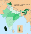
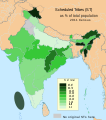
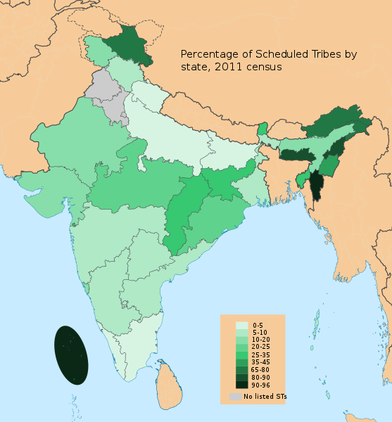
English: This demographic map shows Scheduled Tribes (ST) as a percent of each state and union territory's population per 2011 Census of India. Mizoram and Lakshadweep had the highest percentage Tribal populations in 2011 among all Indian states/UT (nearly 95%), while Punjab and Haryana had 0%.

Scheduled Tribes are also known as Ādivāsīs. Adivasi is an umbrella term for a heterogeneous set of ethnic and tribal groups who inhabit different parts of India. Different tribes live in mountainous northeastern states, dry areas of western states, the forests of central and eastern states, the islands of Bay of Bengal and Arabian Sea, as well as other areas. Officially recognized by the Indian government as Scheduled Tribes in the Fifth Schedule of the en:Constitution of India, they are often grouped together with scheduled castes in the category "en:Scheduled Castes and Tribes", which is eligible for certain affirmative action measures.

Data Source: Census of India 2011, Primary Census Abstract - Scheduled castes and scheduled tribes, Office of the Registrar General & Census Commissioner, India (October 28 2013).

The data can be viewed in a Powerpoint presentation on a Government of India Census website here.

The state and disputed national borders SVG code used to create this map is a derivative work of File:India literacy rate map en.svg available on wikimedia commons.
दिनांक
स्रोत अपना कार्य
लेखक M Tracy Hunter

लाइसेंस

मैं, इस कार्य का/की कॉपीराइट धारक, इसे निम्न लाइसेंस के अंतर्गत प्रकाशित करता/करती हूँ:
w:hi:क्रिएटिव कॉमन्स
श्रेय समानसांझा
इस फ़ाइल को क्रिएटिव कॉमन्स श्रेय-समानसांझा 3.0 अनरिपोर्टेड लाइसेंस के अंतर्गत लाइसेंस किया गया है।
आप खुलकर:
  • बाँट सकते हैं – रचना की प्रतिलिपि बना सकते हैं, बाँँट सकते हैं और संचारित कर सकते हैं
  • रीमिक्स कर सकते हैं – कार्य को अनुकूलित कर सकते हैं
निम्नलिखित शर्तों के अंतर्गत:
  • श्रेय – यह अनिवार्य है कि आप यथोचित श्रेय प्रदान करें, लाइसेंस की कड़ी प्रदान करें, और अगर कोई बदलाव हुए हों तो उन्हें इंगित करें। आप ऐसा किसी भी उचित तरीके से कर सकते हैं, लेकिन किसी भी तरह उससे यह नहीं संकेत नहीं किया जाना चाहिए कि लाइसेंसधारी द्वारा आपको अथवा आपके इस प्रयोग का समर्थन किया जा रहा हो।
  • समानसांझा – अगर आप इस रचना में कोई बदलाव करते हैं या इसपर आधारित कुछ रचित करते हैं तो आप अपने योगदान को सिर्फ इसी या इसके सामान किसी लाइसेंस के अंतर्गत बाँट सकते हैं।

Captions

Add a one-line explanation of what this file represents
Indian states and territories by Scheduled Tribe population, 2011

Items portrayed in this file

चित्रण

source of file अंग्रेज़ी

original creation by uploader अंग्रेज़ी

media type अंग्रेज़ी

image/svg+xml

checksum अंग्रेज़ी

2da5aa2ef32f3df19038a4df6de3b861b4a0ba2d

data size अंग्रेज़ी

१४,६५,३७७ बाइट

१,६१५ पिक्सल

width अंग्रेज़ी

१,५०० पिक्सल

चित्र का इतिहास

फ़ाइलका पुराना अवतरण देखने के लिये दिनांक/समय पर क्लिक करें।

दिनांक/समयथंबनेलआकारसदस्यप्रतिक्रिया
वर्तमान21:21, 26 जनवरी 202121:21, 26 जनवरी 2021 के संस्करण का थंबनेल संस्करण1,500 × 1,615 (1.4 MB)C1MMRelabeled to better show diversity
18:12, 1 जून 202018:12, 1 जून 2020 के संस्करण का थंबनेल संस्करण1,141 × 1,287 (1.44 MB)C1MMFixed bounadaries
23:51, 21 मार्च 202023:51, 21 मार्च 2020 के संस्करण का थंबनेल संस्करण1,141 × 1,287 (1.87 MB)C1MMIncreased size
23:47, 21 मार्च 202023:47, 21 मार्च 2020 के संस्करण का थंबनेल संस्करण512 × 512 (1.87 MB)C1MMAdded Ladakh and removed unnecessary text
23:06, 3 जुलाई 201423:06, 3 जुलाई 2014 के संस्करण का थंबनेल संस्करण1,578 × 1,738 (863 KB)M Tracy HunterUser created page with UploadWizard

निम्नलिखित पन्ने इस चित्र से जुडते हैं :

चित्र का वैश्विक उपयोग

इस चित्र का उपयोग इन दूसरे विकियों में किया जाता है:

मेटाडेटा